Data-Rich to Risk-Ready
The DAIS framework transforms reactive ground data into proactive intelligence. We don't just digitalize; we enable predictive certainty for global infrastructure.
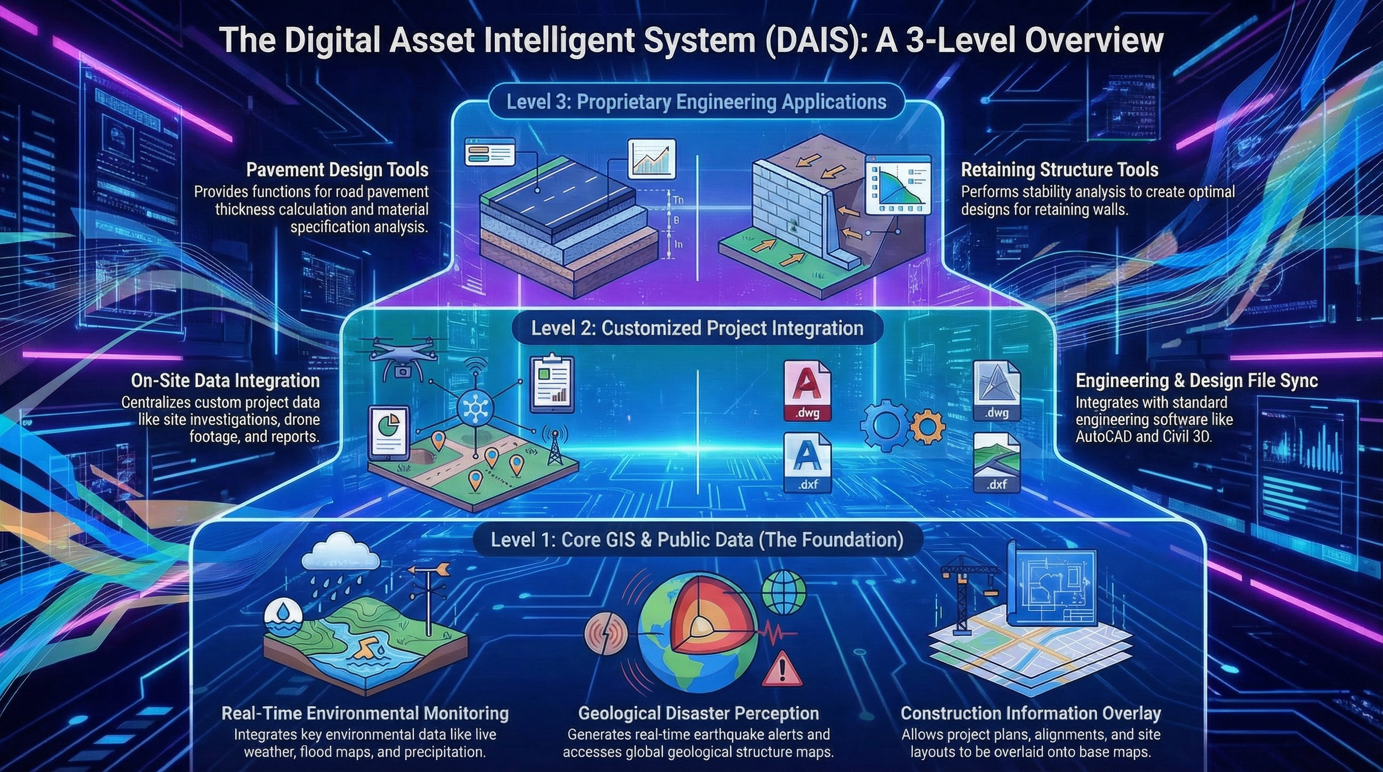
The 3-Level Digital Intelligence Framework
Our proprietary DAIS ecosystem integrates complex geotechnical data streams into a unified predictive engine. From spatial context to AI-driven decision support, we bridge the gap between raw monitoring and engineering action.
Core GIS Foundation
High-fidelity spatial data hosting and coordinate synchronization.
Project Integration Layer
Breaking silos through multi-sensor synchronization and API-first architecture.
Engineering Intelligence
Advanced neural networks providing automated risk scoring and predictive modeling.
Intelligence Services
Our suite of services provides 360-degree protection for complex civil engineering projects.
"Reduces geotechnical incident risks by up to 45% through 24/7 automated vigilance."
"Ensures 100% data visibility across all project stakeholders in a unified interface."
"Saves over 120 engineering hours per month per project through automation."
Technical Specifications
Built on high-performance architecture for zero-latency geotechnical monitoring.
Why Geotechnical Intelligence?
Zero-Failure Objective
Our AI models are trained on historical failure data to identify the earliest precursors of instability.
Real-Time Decision Support
Instant alerts and automated engineering insights deliver certainty when every second counts.
Seamless Project Lifecycle
From site investigation to long-term monitoring, GI provides a continuous thread of digital truth.
Ready to secure your project?
Join leading engineering firms using DAIS for predictive geotechnical certainty.
Request Platform Demo